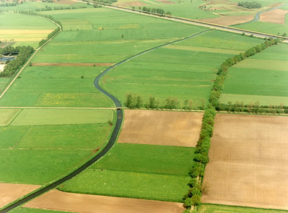
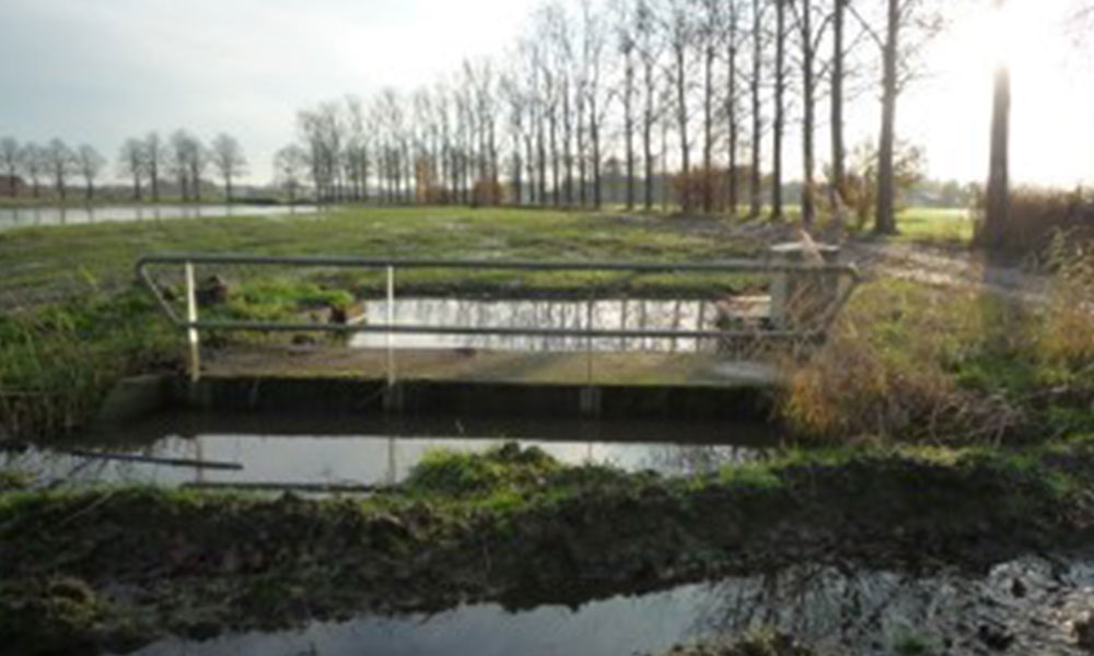
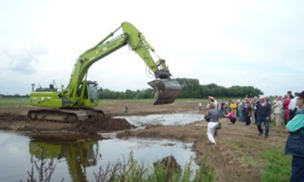
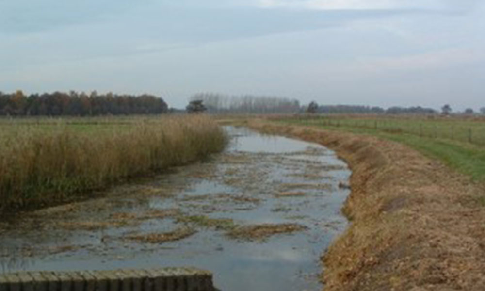
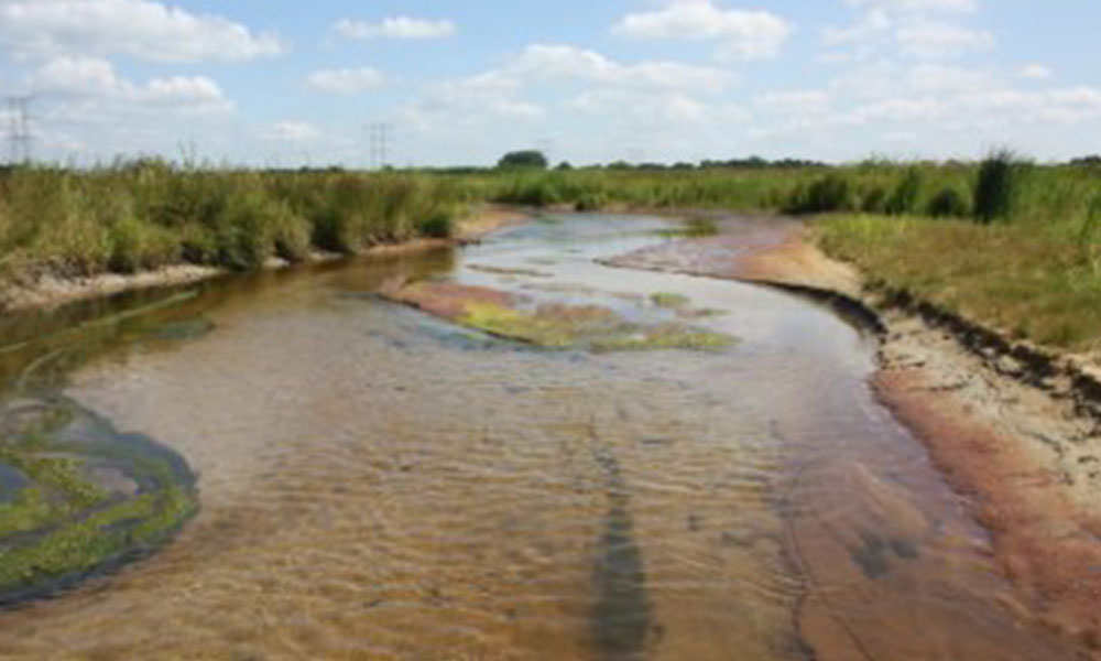
In 2010, four weirs were removed on the Reusel Brook in the south of The Netherlands, restoring a stretch of the river for the benefit of a variety of fish species.

The Reusel Brook flows from Reusel to Oisterwijk and then into the River Essche (the Essche Stroom). The restoration and removal of the weirs took place near Diessen and Moergestel, villages in the province of North Brabant.

The work was carried out to comply with the EU Water Framework Directive and Dutch national plans to restore the best of the rivers and wetlands in The Netherlands (‘Natte natuurparel herstel’). The plans for these weir removals arose from the water management plan which the local water company writes every six years.

The Reusel was an important water course for fish in the past. Burbot, brook lamprey and pond loach lived in the streams and brooks around the Reusel but most of these disappeared in the period from the 1940s to the 1970s when the river was canalised and straightened and the weirs were built.

Aerial view of the straightened and canalised Reusel Brook

By removing the barriers, there was potential to open up the river for a variety of fish species to travel upstream – not just burbot, brook lamprey and pond loach but also dace, chub and Crucian carp.

  • Name:Four weirs on the Reusel Brook
  • Location: North Brabant, The Netherlands
  • Type of dam: Weirs built for water management
  • Measurements: 5m to 7.5m long and 2m high
  • Year of removal: 2010

History

The weirs were installed in the 1960s by the local water company, Waterschap De Dommel, to create river banks that were more stable for intensive agricultural use. The Reusel is currently owned and managed by Waterschap De Dommel and the river banks and surrounding land are owned by the Brabant Landscape Foundation.

The weirs were 5 to 7.5 meters long and about 2 meters in height.

An old weir on the Reusel Brook

There were negative impacts from canalisation and weir construction: the Reusel’s old meander was blocked, the brook looked unpleasant and unnatural and its stream dynamics had altered. The length of the brook that was affected was 8500 meters. Although the weirs were not in violation of any state laws, there were problems reaching a good standard of water quality to comply with the Water Framework Directive.

Planning the removal and cost

The removal of the weirs was part of a plan to restore not only the brook but also the wetlands along its banks. Historical records showed that brook lamprey and pond loach had been common – older people in the area remembered these species being present – and it was hoped to improve the aquatic habitat for these and other fish species and macro-invertebrates by creating a more naturally-flowing stream, and to restore the wetlands for waders such as the water rail, common snipe, black-tailed godwit and Eurasian curlew and uncommon birds such as the bluethroat. At the same time, this project aimed to improve water quality by restoring the flow of ground water and removing intensive use of the valley by agriculture.

The stakeholders involved in the decison-making process were the local water company (Waterschap De Dommel), the provincial government of Noord-Brabant, Brabant Landscape Partnership, the State Forest Management, the townships of Hilvarenbeek and Oisterwijk and local communities and farmers.

As the weir removals were a small part of the much larger water management and river restoration plan, the cost of removing them was not individually specified but was included in the total cost for the whole project. The main funding contribution was a subsidy from the provincial government of North Brabant.

The removal process

In 2010, the area underwent a complete transformation: sixty hectares of soil were excavated, new meanders were created and the weirs were removed. This allowed the water to find its own way again through the Reusel valley. Each weir took about half a day to demolish and remove as a part of the two-year project. The contractor and the project management was under the supervision of DLG (Dienst Landelijk Gebied – Rural Area Service), a special task force which was given the responsibility by the local authorities to carry out nature restoration projects.

Local people gather to watch the start of the project

Work in progress

Effects of removal

Fish stocks were monitored immediately after the river restoration and weir removals were completed. The results showed that the variety of fish species in the Reusel has become more diverse with populations of rheophilic species, those typically found in flowing water, showing a large increase, for example, in the number of spined loach and gudgeon. The pools and puddles in the valley now contain fishes and have become nurseries for the fry of different fish species.

The newly-engineered river dynamics ensure natural water-level management with high levels in the winter and lower levels in the summer. This has encouraged wetland plants, such as the water purslane, floating club-rush and water mudwort, to thrive, in turn creating an oasis for marsh and meadow birds.

The habitats for fishes, plants, birds and other species have been restored and enhanced by this work. However, important target species – burbot, chub and pond loach – are still missing from the Reusel and its wetland margins as there are barriers downstream that are yet to be removed…

Mark Scheepens from the Dommel Water Company adds:

There are still dams to be destroyed and more work to be done to improve the fish stocks. We haven’t restored the whole Reusel area and that is why it isn’t developing according to its full capacity. There are two weirs which prevent fish from migrating between the Diessens Brook and the Essche Stroom so we didn’t record any new species because they cannot migrate further into this system. We have written in our Water Management Plan that these barriers will either be removed or be reconfigured to allow fish to migrate further upstream along the Reusel. This may happen in a couple of years but at least before 2027.

The Reusel Brook before and after restoration

With many thanks to Mark Scheepens, Monitoring Consultant at Waterschap De Dommel, for information and the aerial photo, and P.Busink for photos of the weir and river restoration works.